Storm Information
Super Typhoon Sinlaku – Resident Safety Advisory
Typhoon Sinlaku Advisory (Updated April 14, 2026)
Horizon Townhouses Association
Updated: April 14, 2026 – Morning
Dear Residents,
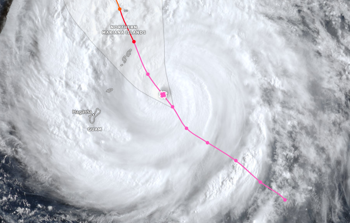
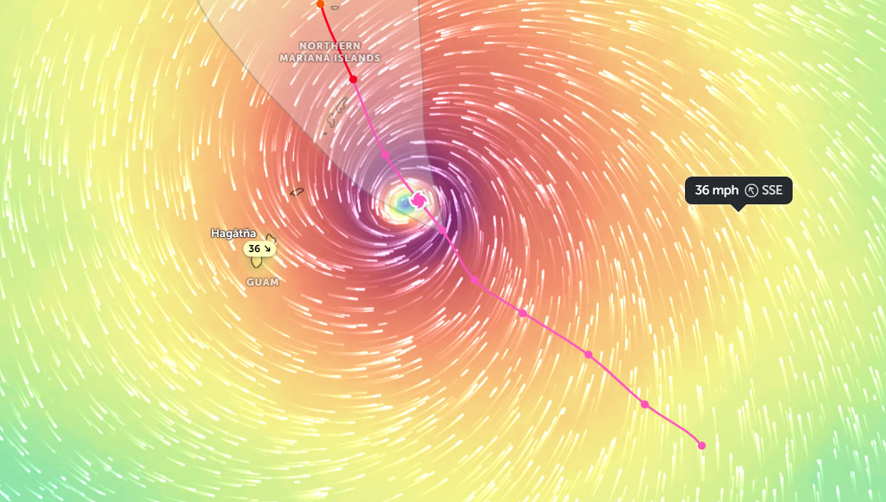
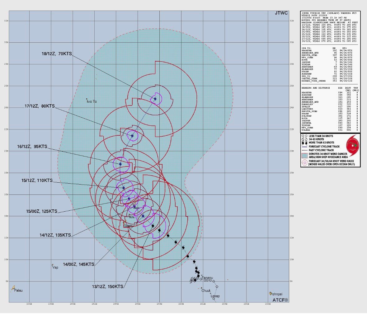
Super Typhoon Sinlaku is currently impacting Guam, and tropical storm-force winds are actively affecting our area. The island remains under Condition of Readiness 1 (COR1), and all residents are required to remain indoors until COR4 (All Clear) is officially announced.
■ Current Conditions
- Sustained winds: 50–60 mph (80–97 km/h)
- Gusts: 70–80 mph (113–129 km/h)
- Heavy rain and strong wind bands continuing across the island
- Power outages reported in multiple areas
The storm’s closest point of approach is expected between 2:00 PM and 4:00 PM today, but hazardous conditions will continue through tonight and into early Wednesday.
■ Resident Safety Instructions
- Stay indoors at all times
- Avoid windows and glass doors
- Do NOT go outside, even if conditions temporarily appear calm
- Do NOT drive or walk outside unless absolutely necessary
Flying debris and sudden flooding remain serious risks.
■ Property & Community Advisory
- Please secure all loose items on patios and balconies (if safe to do so)
- Do not attempt to inspect damage until the all-clear (COR4) is announced
- Be aware that common areas may not be safe during and immediately after the storm
- HOA maintenance and response operations may be delayed due to weather conditions
■ Utilities & Services
- Power outages and water disruptions are possible
- Emergency services may be limited and delayed
- Please conserve phone battery and use devices only when necessary
■ Important Reminders
- Use flashlights only (do not use candles)
- Stay away from downed power lines and flooded areas
- Keep essential items (water, medications, emergency supplies) nearby
■ Emergency Contacts
- Emergency: 911
■ Message from the HOA
Your safety is our top priority.
Please remain calm and stay sheltered until authorities confirm it is safe to go outside.
We will continue to monitor the situation and provide updates as conditions improve.
Bill Nault
President
Horizon Townhouses Association